
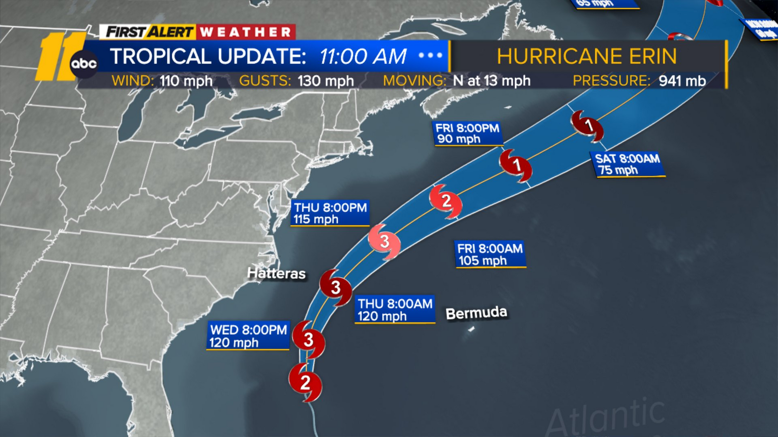
NAGS HEAD, N.C. (WTVD) — Hurricane Erin, is moving closer to the North Carolina coast and threatens to whip up wild waves and tropical-force winds.
North Carolina Governor Josh Stein gave an update on the storm as it moves closer to the state.
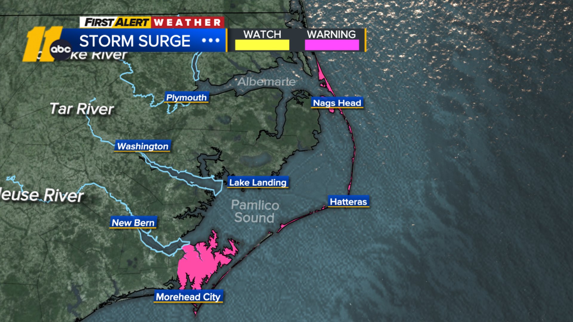
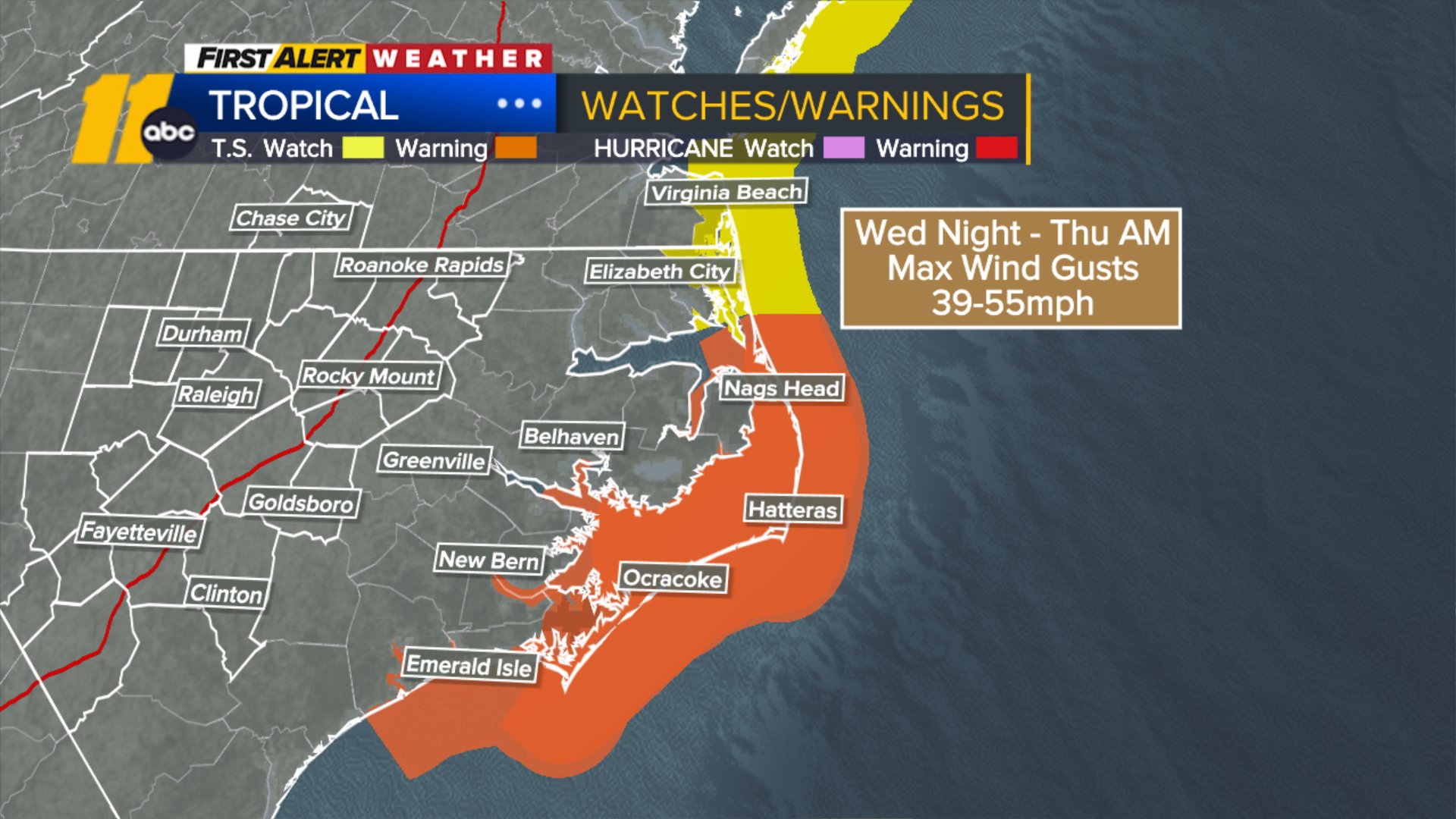
Erin’s outer bands will start grazing the Outer Banks tonight, with increasing wind gusts of 40-60 mph. Wave heights of 10-20+ feet will be possible tonight into tomorrow as Erin moves north. NC 12 may be partially or completely washed out in sections due to the waves. 2-4 feet of surge is forecast for the Outer Banks and coastal erosion is expected as well. Rain totals of 1-2 inches will be possible for that region.
Winds will pick up Wednesday night into Thursday morning.
Evacuations were ordered on Monday and Tuesday along the Outer Banks as authorities warned that the storm could churn up dangerous rip currents and swamp roads. A Storm Surge Warning and Tropical Storm Warning are in effect for the Outer Banks and parts of the NC coast.
View from the International Space Station show the massive size of Hurricane Erin
NC coast braces for Erin
Erin lashed parts of the Caribbean with rain and wind on Monday. Forecasters are confident it will curl north and away from the eastern U.S..
Officials at Wrightsville Beach, near Wilmington, reported rescuing at least 60 swimmers from rip currents on Monday.
On the Outer Banks, coastal flooding began Tuesday and should continue through Thursday. Hyde County has enacted a local State of Emergency for Ocracoke Island. Dare County has declared a local State of Emergency and implemented a mandatory evacuation for Hatteras Island, which includes the communities of Rodanthe, Waves, Salvo, Avon, Buxton, Frisco, and Hatteras.
Families heed evacuation warnings on NC coast ahead of Erin and cut vacations short.
The storm is expected to swing to the northeast late Wednesday night into Thursday morning, where it comes closest to the coast. At this time, it looks to be around 200-250 miles from shore.
There are a myriad of impacts: rain of up to 2 inches, wind of up to 50 mph, and a surge of up to 6 feet are all possible from today through late Thursday. NC12 along the Outer Banks will probably sustain damage that makes it impassable in sections. There has already been water that has overtopped the road at high tide on Tuesday.
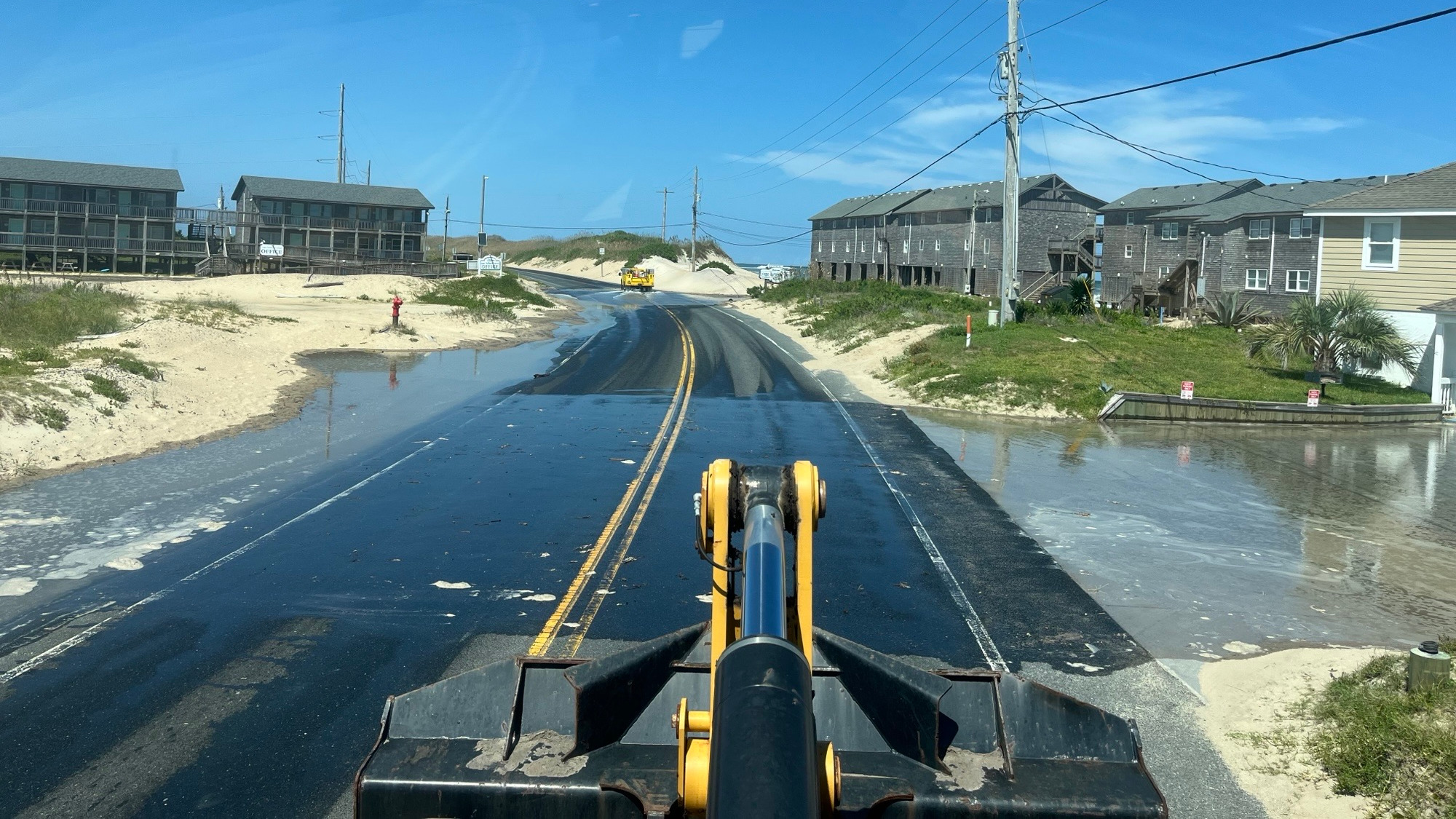
NC12, Tuesday, August 19, 2025: (Photo Credit: NCDOT)
Even in fair weather, beaches will remain dangerous through Thursday night with waves of 10-20 feet. There were 85 rip current rescues along the NC coast yesterday alone.
The evacuations on Hatteras Island and Ocracoke came at the height of tourist season on the thin stretch of low-lying barrier islands that jut into the Atlantic Ocean and are increasingly vulnerable to storm surges. Most extreme impacts are expected on Hatteras, but those north of Oregon Inlet–on the northern beaches–should also remain alert.
“It is imperative that any visitors on Hatteras Island who have not already evacuated do so immediately, before travel becomes unsafe and your safety is put at risk,” Dare County Emergency Management Director Drew Pearson said in a new release.
A year ago, Hurricane Ernesto stayed hundreds of miles offshore yet still produced high surf and swells that caused coastal damage. This time, there are concerns that several days of heavy surf, high winds, and waves could wash out parts of the N.C. 12, making some routes impassible for days.
This is the first evacuation for Ocracoke since Hurricane Dorian in 2019, which caused the most damage in the island’s recorded history.
Tommy Hutcherson, who owns the community’s only grocery store, told the Associated Press that the island has mostly bounced back. He’s optimistic this storm won’t be as destructive.
“But you just never know. I felt the same way about Dorian, and we really got smacked,” he said.
Scientists have linked the rapid intensification of hurricanes in the Atlantic to climate change. Global warming is causing the atmosphere to hold more water vapor and is spiking ocean temperatures, and warmer waters give hurricanes fuel to unleash more rain and strengthen more quickly.
The Associated Press contributed to this report.
Copyright © 2025 WTVD-TV. All Rights Reserved.