
ASHEVILLE, N.C. (WLOS) — Hurricane-force winds in Helene brought down millions of trees.
We don’t often see winds this severe from a tropical system this far inland.
The storm of record for wind damage in North Carolina was Hugo in 1989. Irma brought significant wind damage to parts of Georgia in 2017.
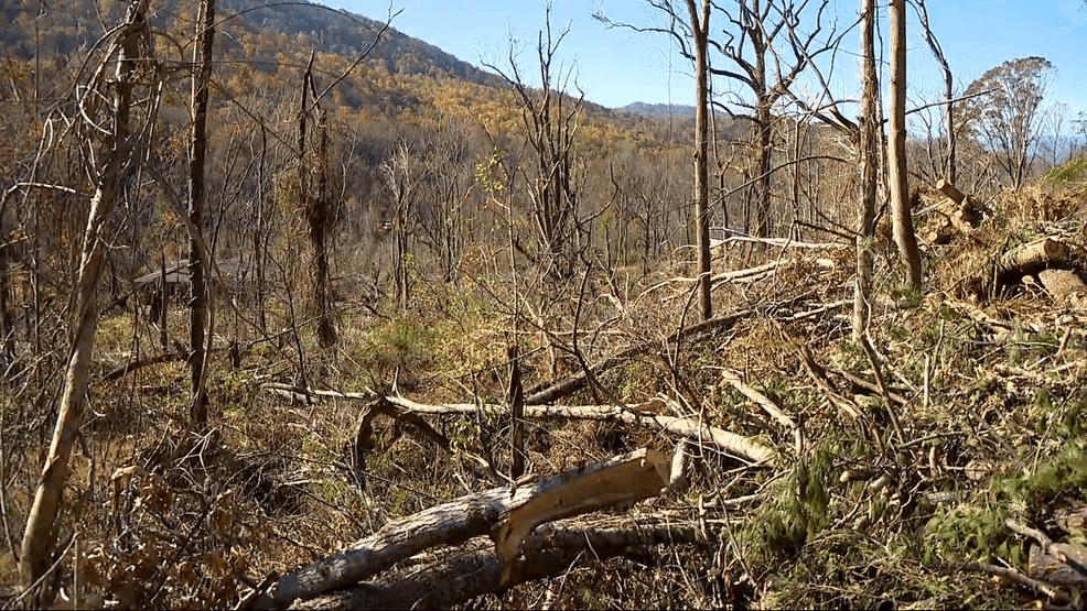
GALLERY: WEBB COVE HIT HARD BY FALLEN TREES DURING HELENE
Helene went through rapid intensification to a category four storm in the 24 hours before landfall. When a storm is that strong at the coast, it takes longer for the wind speeds to weaken as it moves inland.
Typically, landfalling tropical systems move slowly at 12 mph to 14 mph. Helene was moving inland after landfall at 28 mph.
Helene was able to carry that category four momentum well inland. As you go inland, the terrain goes up.
“The higher you go up in a storm or the higher in the atmosphere the stronger the winds are going to be, so as we go up in terrain here in WNC, it’s able to tap into those stronger winds aloft in the remnant tropical cyclone,” Trisha Palmer, Warning Coordination Meteorologist at the National Weather Service Office in Greenville-Spartanburg, said.
Helene was downgraded and was technically a tropical storm in western North Carolina because that designation is based on sustained wind speed, but we had hurricane-force wind gusts everywhere.
RECENT HURRICANES SHOW TREND OF STRONGER, WETTER STORMS IN NORTH CAROLINA
“The top of Mount Mitchell gusted to 106 mph. We had widespread pockets of 80 to 90 mph wind gusts. So, you take those gusts, and you put it on top of the saturated soils, and the trees start rocking back and forth and they just couldn’t handle it,” Palmer said.
Adding to the weight of those trees was full foliage. We often see high winds in the cold season with fronts, but there are no leaves on the trees at that time.
The North Carolina Forest Service estimated that 822,000 acres of timberlands in the state were damaged, including more than 130,000 acres in McDowell County.
Power outages were unprecedented.