
After weeks of staring down what many would consider a bleak snow forecast, avalanche specialists are now on high alert as backcountry conditions are quickly shifting across Colorado. Experts say people planning to recreate should take extra precautions.
“It’s an intense week, with rising avalanche danger in most of the state,” said Ethan Greene, director of the Colorado Avalanche Information Center.
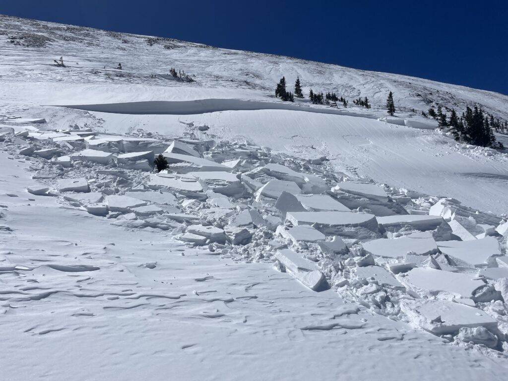
Large portions of the state are now under high avalanche danger, meaning human-triggered avalanches are very likely and natural avalanches are possible.
Because of the high risk, CAIC is working with the Colorado Department of Transportation to do avalanche mitigation in some regions. “That can include triggering avalanches to protect state and federal highways,” Greene said.
Some of that work is happening Wednesday along with evaluations at local ski resorts. “So if someone is going to a ski area, they really just need to make sure that they are staying on open trails because the ski area will close areas in preparation to do avalanche work,” he said.
One place avalanches are not purposely triggered is the backcountry. But the risk there is especially elevated. Even when storms taper off, Greene said the danger isn’t expected to disappear quickly.
“We expect to see elevated avalanche conditions through the weekend,” he said. “As the storm moves out, we’ll probably drop down into considerable avalanche danger, but the chance of a human-triggered avalanche remains quite high.”
On Wednesday morning nine backcountry skiers near Lake Tahoe were still missing after an avalanche occurred following a severe winter storm, according to the Associated Press. Six others were rescued, and a search is underway in challenging conditions.
So far in 2026, the Avalanche Center has recorded 1,644 avalanches statewide. Officials estimate they likely capture only about 20% of total activity. Most slides recorded earlier this season were smaller because of Colorado’s thin snowpack. But that could change with this storm.
“With this heavy snowfall, we expect to be seeing some size three avalanches probably today or tomorrow,” Greene said.
On the avalanche size scale, a Level 3 is large enough to destroy a vehicle or a timber structure. Most human fatalities happen at levels 2 and 3.
Colorado’s snowpack has been thin for much of the winter, creating weak layers of snow near the ground. New snow piling on top makes that structure unstable.
“In general, when we have a thin snowpack, it turns into a weak structure,” Greene said. “That’s really not a problem until you put something on top of it, and that’s what we’re doing right now. It’s really just a house of cards.”
The central mountains, including areas between Crested Butte and Aspen, could see some of the largest slides. But Greene says danger is widespread.
“There’s a lot of red out there right now,” he said, referring to the CAIC map. “Wherever people are going, the most important thing they can do is check the avalanche forecast.”
When avalanche danger is high, Greene says the safest move is to avoid avalanche terrain altogether, meaning slopes steeper than about 30 degrees. This week, he suggests also avoiding activity under steep grades as well, as the risk of triggering an avalanche from below is higher than usual.
Still, if you’re eager to get out into the fresh powder, the right gear is necessary.
“Carrying rescue equipment is non-negotiable,” Greene said. “That would be an avalanche rescue transceiver, a probe and a shovel.” You should also carry standard winter survival gear including food, water, proper layers and a communication device.
More storms are possible next week, and danger levels could rise again. To stay up to date and ensure your safety, check the regional forecasts here.