
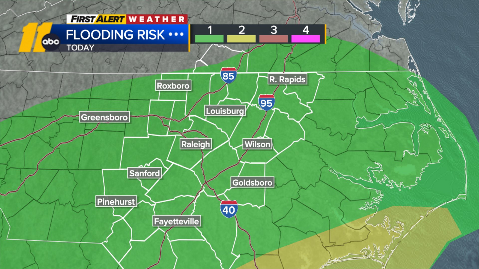
RALEIGH, N.C. (WTVD) — Rain and storms are back in the forecast today as humidity continues to rise. Most storms will pop up during the late-afternoon and evening hours before tapering off tonight. Locally heavy rain may lead to street flooding today and Tuesday.
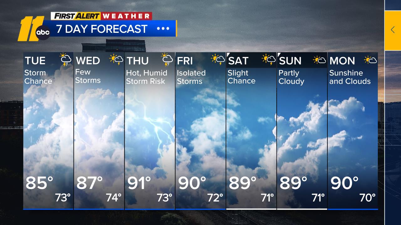
This pattern persists through much of the week. Dew points will generally remain in the 70s for much of the week, so expect a humid feel in the air. An afternoon thunderstorm or two will also be likely each day.
Highs will slowly climb during the week back into the upper 80s and near 90 by Thursday as high pressure strengthens. The peak of the highs sets in by the weekend, leading to highs int eh low 90s Thursday through the weekend. Weekend shower and storm chances will be spotty.
1. Eastern Tropical Atlantic (Tropical Storm Erin): Tropical Storm Erin has formed as of the 11 am Advisory from the National Hurricane Center. Erin will likely become a hurricane by Wednesday, and could become a major hurricane by this weekend. The current track takes it to the west near the Leeward Islands before curving out to sea. This bears watching in the days to come to see when exactly the storm makes that curve.
2. Central Atlantic (AL96): Disorganized showers and thunderstorms continue in association with a trough of low pressure located over the central tropical Atlantic. Some gradual development is possible during the middle part of this week while the system moves generally northward over the central Atlantic.
* Formation chance through 48 hours…low…10 percent.
* Formation chance through 7 days…low…20 percent.
Have a great day!
Cruz Medina
Copyright © 2025 WTVD-TV. All Rights Reserved.